Welcome to Drone 3D Modeling For Beginners!
This course covers the basics of creating interesting 3D Models / Maps with drones. There is a lot of upfront investment if you're interested in drone 3D Modeling for a business, so before you dive in you should have the basics down.
This is not an introductory course for Drone Flight. Students in this course should have the basics of drone flight mastered before looking into Drone Modeling.
Class Curriculum
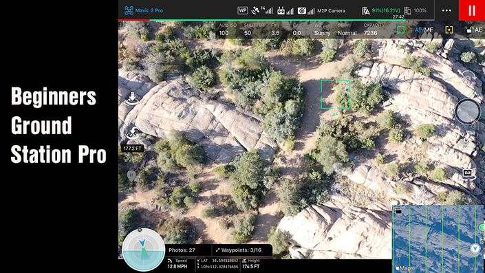
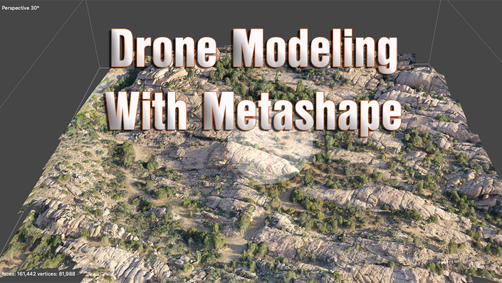
- Photoscan Model Build - 19.19 acre model generated with Map Pilot and Mavic2 Pro (18:05)
- Reviewing the final Lake Shore Model with Photoscan - Photoscan Basics (9:01)
- Another small model build using Photoscan, Drone Deploy, and Maps Made Easy. (13:33)
- Sharing a Photoscan Model Online - Exporting the house model for Sketchfab (8:11)
What you will learn about in this course
This course covers the basics of creating interesting 3D Models / Maps with drones. There is a lot of upfront investment if you're interested in drone 3D Modeling for a business, so before you dive in you should have the basics down. In order to generate 3D Models with UAVs you need several things:
- A drone with a camera. DJI Drones are used for this course, but you can create 3D models with many drones.
- A computer for offloading your captured images. Windows and Mac systems are both viable. For high end and large models you'll need a faster computer for model generation.
- Access to 3D Modeling rendering software. Cloud based solutions and desktop solutions both exist.
- Lot's of patience.
This course covers "Photogrammetry." The dictionary definition of this topic is, "The use of photography in surveying and mapping to measure distances between objects." Today's Photogrammetry goes beyond just measuring distances and is not just used for surveying and mapping. 3D Modeling today with drones can provide realistic models of land, businesses, homes, accident scenes, and more. Drone Photogrammetry is beginning to show up in multiple industries across the world.
This course does not cover the high end topics for modeling, and is instead an introduction to the basic topics. In the class we will:
- Look into several 3D Modeling image capture Apps for smart phones and tablets.
- Talk about planning your model prior to heading to your selected location.
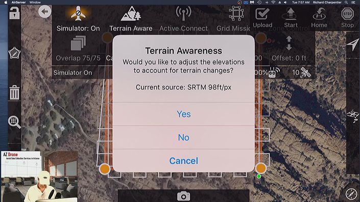
- Demonstrate planning a mission with Map Pilot from Maps Made Easy.
- Fly a 19.19 acre modeling mission with Map Pilot.
- Process the 19.19 acre mission with Photoscan Standard (available on Windows and Mac OSX).
- Share the created model via Sketchfab.
- Creating a small 3D Model mission of a new home with Litchi (Android and iOS capture App) using only a short orbit of the home.
- Process the mission with Drone Deploy, Maps Made Easy, and Photoscan Standard, and compare the outputs from the 3 platforms.
- Share your small home model with Drone Deploy, Maps Made Easy, and Sketchfab (with data from Photoscan).
- Discuss the differences between the model rendering software (Pix4D, Drone Deploy, Maps Made Easy, Photoscan).
- Discuss the costs of generating your models before you sign up with a particular service, or purchase a stand alone desktop application.
- Discuss a "free" option from Pix4D to test your models.
When students complete this class they'll have a basic understanding of how to plan for their Drone 3D Models, utilize 3D image capture applications for drones, process their 3D models with a variety of services and software, and share their final renders with the world. This class will not teach students how to do high end commercial 3D Modeling, but will leave students with the building blocks to take their interest in 3D Modeling further.
Finally, a big intent for this course is to help drone pilots learn about 3D modeling with drones without breaking the bank. As students investigate the costs of generating these models they'll learn about the hidden costs and obvious costs. Higher end drones aren't cheap. Cloud processing could cost you thousands of dollars per year. Desktop photogrammetry software licensing can cost thousands of dollars per year. And a properly built 3D modeling computer can run into thousands of dollars quickly. This course identifies each of these financial barriers and allows students to begin learning about 3D modeling without a high investment.

Featured Products
If you're interested in more classes to help you build your drone modeling skills, we'd suggest checking out the following courses!